Flood monitoring from space: A Q&A with flood expert Beth Tellman
June 27, 2024
Image
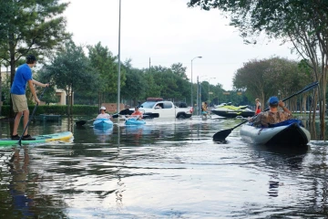
Beth Tellman, an assistant professor in the University of Arizona School of Geography, Development, and Environment in the College of Social and Behavioral Sciences, uses satellite imagery to improve our understanding of where floods have happened and are currently happening. She also uses machine learning models to develop datasets for flood monitoring. Her work aims to improve assessment of populations vulnerable to flood exposure and aid in the understanding of interactions between land cover, climate change and floods.
Tellman talked to University of Arizona News about how flood maps are created and how satellite monitoring helps translate people's flood experiences into maps for policymakers.